
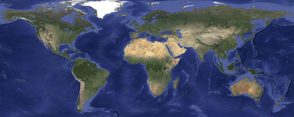
Google has made vast improvements to its Earth satellite imagery across several of its products, cleaning up previous bad images and wiping even clouds from the skies.
The improvement virtually eliminates clouds, includes refreshed imagery for regions of the world where high-resolution imagery is not yet available, and offers a more comprehensive and accurate view of the texture of our planet's landscape.
Using Google Earth Engine technology, Google's engineers mined hundreds of terabytes of data from the USGS's and NASA's Landsat 7 satellite, resulting in an image of the entire planet with a resolution of 15 meters per pixel.
The resulting 800,000 megapixel global image is so big that if you wanted to print it at a standard resolution of 300 dots per inch you would need a piece of paper the size of a city block.
Check out Google's Maps blog for pictures highlighting improvements.
Tags:
Google Maps


